StatsDistance: 67.7 mi
Average Speed: 10.5 mph; Max Speed: 32.5 mph
Elevation Gain: 5,279 ft
Average Temp: 72.5 F; Temp Range: 48.2-100.4 F
Story:
The campground I passed up last night had a sign about bears having been spotted in the vicinity. I try not to keep food in or near my tent anyway, but it was still a relief to see my front panniers where I had left them. Both had been visited by a small rodent (it left a present behind, which I flicked off) but no damage had been done.
I woke up about quarter to 5 to a brisk morning. I considered getting up and starting my ride as it was already getting light, but I opted instead to snuggle back into my quilt and go back to sleep. By the time I woke up again and got on the road it was a bit after 8, though the morning was still brisk. A TransAm racer stopped to chat for a bit as I was doing my final “do I have all my stuff” check. His race isn’t going as well as he had hoped, thanks in part to a head cold slowing him down. I hope it clears up for him soon.
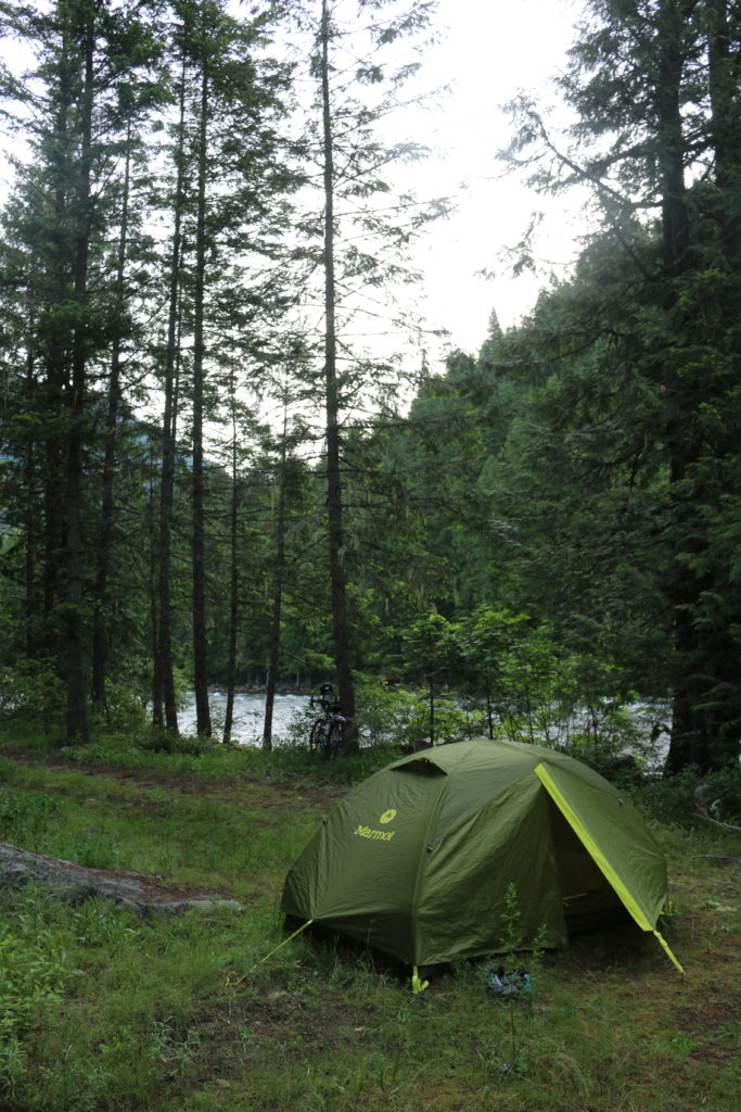
Where I woke up, Day 17
Route 12 was very similar to how it was yesterday: sporadic traffic in the form of a truck or a few RVs, long winding stretches of empty road with the river always to my right, and looming mountains on either side.
The big event of the day, though, was going over Lolo pass. I like to watch the climbs on my GPS, setting the horizontal and vertical scales of the elevation profile so that the peak of the mountain is visible and adjusting every so often to keep it on the edge of the screen. I did a lot of adjusting today, since I wouldn’t reach the pass until 50 miles into my ride.
Most of that was slow climbing: enough to keep me out of the big chainring but not enough to make me feel as though I was struggling. It was peaceful and quiet except for the rushing of the river, and immensely enjoyable.
A few miles from the pass, the road gets significantly steeper. Not terrible, mind, but enough to invoke the smallest chainring. And I planned my day super-well in that I hit this part of the ride just around midday. There were some clouds to keep the worst of the sun off me, but it was still hot with enough humidity to be noticeable but not oppressive.
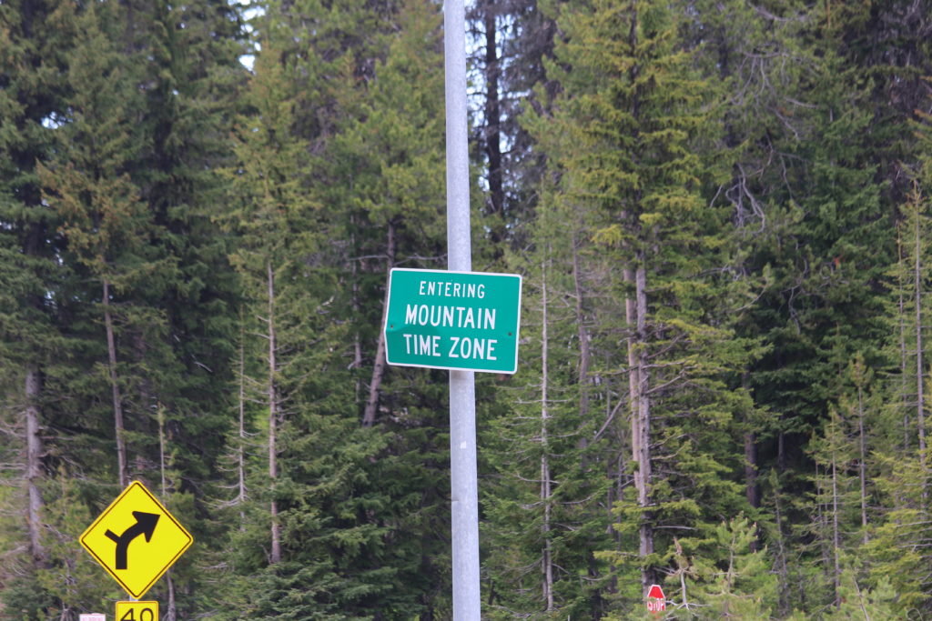
The top of the pass was doubly exciting. Not only did I get over another mountain, but I crossed into a new state. Lolo Pass sits right on the boundary between Idaho and Montana! Also, I’m back in the Mountain Time Zone. Only there’s no cell signal and hasn’t been for nearly 100 miles, so I’ll have to set my alarm with that in mind.
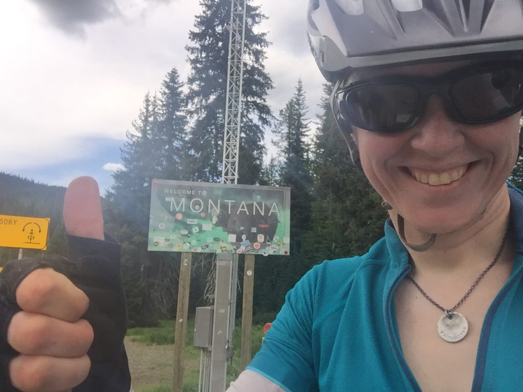
Lolo Pass and the Montana Border! A double victory.
What, again? Okay, but this had better be the last time.
A lot of the landscape is similar on this side of the pass: mountains covered with tall conifers. There is one big difference that I saw almost immediately, though: large, bare rock formations. There were things like pillars of rock and faces of exposed rock on the mountainside. They’re almost like Rorschach Tests or staring at clouds. “What shape do you see in that one?” “Hmm…I think it looks like a monkey.” “Nah, it’s definitely a whale.”
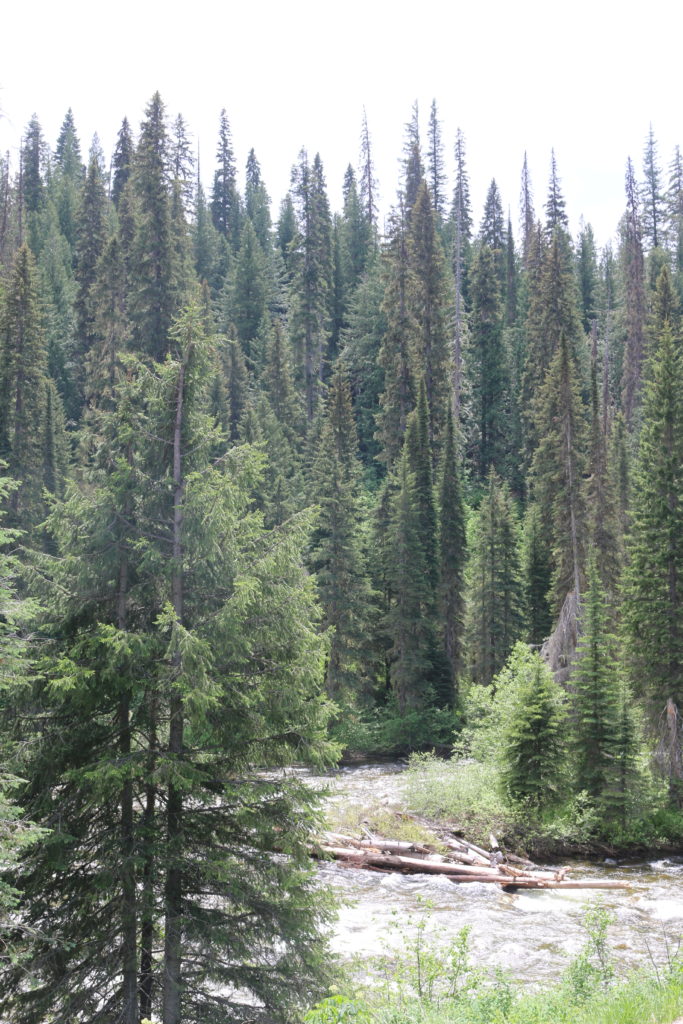
No big standing rocks here, but the river sure is pretty.
I had originally planned to end the day at Lolo Hot Springs, a quick 8 miles downhill from the peak. Soaking in some hot springs sounded like a great idea when I was planning my stops a few days ago, but I got there around 3PM and was feeling alright, so thought I would try to push a bit further.
I rode about 10 miles further and ended up at Lolo Creek Campground. The next campground past that was about another 10 miles, which I could have done. What decided me was the drizzle that started as I pulled in to check out the site. Even though I still have no cell signal (and thus no way to reassure the family that I haven’t been trampled by a moose), I decided that it would be worth it to be dry.
Perhaps the next campground might not have had so many mosquitoes, though. Gah! I broke out the bug spray and then put on my rain gear for good measure. That won’t work when it gets hotter, but it was comfortable enough tonight.
The rain came in brief and not very strong showers, so I managed to set up camp, cook and eat dinner, and stow my food in the bear-resistant storage unit nearby all without getting wet.
Tomorrow I’ll press on to Lolo and then take the detour up to the Adventure Cycling Association HQ in Missoula, before heading back to the trail and swapping to MAP 4! Another state down today, another map section down tomorrow!
Roadkill count: 2 birds, 1 skunk
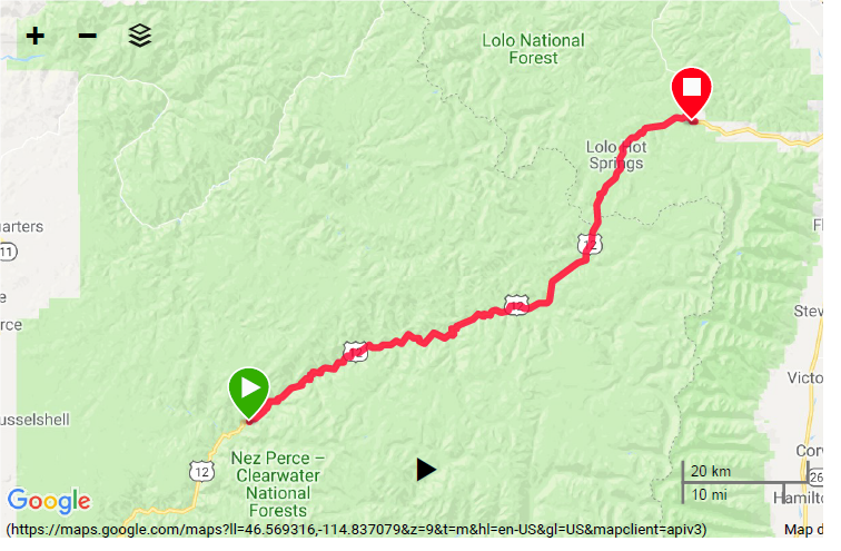
Map Day 17


Hot springs did sound like a great idea. Oh well! Maybe you’ll get a chance at those somewhere else. Safe travels!
Lions and tigers and bears (and moose) oh my! The scenery is something we missed with the RV. Glad you are having this wonderful experience.
It looks so fantastic! I am enjoying your stories and pictures! Montana is really pretty. Stay well, and keep posting! It’s fun traveling with you!